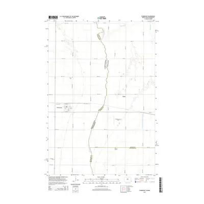
2014 Map of Fairmount
USGS Topo · Published 2014About this map
The Bois de Sioux River defines the border between North Dakota and Minnesota in this 2014 survey, winding northward through the Red River Valley. The town of Fairmount serves as the primary settlement on the North Dakota side, characterized by a structured grid including S Front St and 1st Ave S. The landscape is defined by its agrarian patterns and critical water management infrastructure, most notably the Judicial Ditch Number Eleven-Ten. To the east, the small settlement of Childs sits near the confluence of local drainages and the Rabbit River. This map is particularly useful for genealogical research, as it identifies three distinct burial sites: Calvary Cem, Fairmount Cem, and Pleasant Hill Cem. The inclusion of the Wetherbee Farm Airport reflects the continued importance of private aviation in supporting the region's large-scale farming operations.
Find a feature on this map
37 named features on this map. Tap any name to fly to it.
Don’t see what you’re looking for? This feature index may not catch every label — zoom into the map to look around manually.
Map Details
Editions of this 2014 Fairmount Map
This is the sole edition of this map. No revisions or reprints were ever made.
Other maps of this area

1904 · Wahpeton
USGS Topo · 1:125,000

1915 · White Rock
USGS Topo · 1:62,500

1918 · White Rock
USGS Topo · 1:62,500

1951 · Wheaton
USGS Topo · 1:62,500

1951 · Campbell
USGS Topo · 1:62,500

1953 · Milbank
USGS Topo · 1:250,000

1953 · Fargo
USGS Topo · 1:250,000

1956 · Fargo
USGS Topo · 1:250,000

1958 · Milbank
USGS Topo · 1:250,000

1964 · Fairmount NW
USGS Topo · 1:24,000