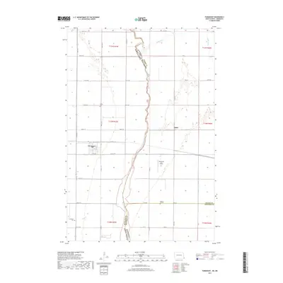
2017 Map of Fairmount
USGS Topo · Published 2017About this map
Fairmount serves as the primary hub in this borderland survey, where the southeastern corner of North Dakota meets the Minnesota state line. The Bois de Sioux River defines the natural boundary between the two states, winding northward through a landscape heavily influenced by drainage engineering like Judicial Ditch Number Eleven-Ten. The map provides significant detail for genealogists, documenting the location of Fairmount Cem, Calvary Cem, and Pleasant Hill Cem spread across the township grids. Transportation and agriculture are the defining characteristics here, with the local Po in Fairmount and the Wetherbee Farm Airport marking the community's connection to the wider region. To the east, the small settlement of Childs sits near the Rabbit River, surrounded by the geometric precision of the Section lines that govern this fertile valley.
Find a feature on this map
40 named features on this map. Tap any name to fly to it.
Don’t see what you’re looking for? This feature index may not catch every label — zoom into the map to look around manually.
Map Details
Editions of this 2017 Fairmount Map
This is the sole edition of this map. No revisions or reprints were ever made.
Other maps of this area

1904 · Wahpeton
USGS Topo · 1:125,000

1915 · White Rock
USGS Topo · 1:62,500

1918 · White Rock
USGS Topo · 1:62,500

1951 · Wheaton
USGS Topo · 1:62,500

1951 · Campbell
USGS Topo · 1:62,500

1953 · Milbank
USGS Topo · 1:250,000

1953 · Fargo
USGS Topo · 1:250,000

1956 · Fargo
USGS Topo · 1:250,000

1958 · Milbank
USGS Topo · 1:250,000

1964 · Fairmount NW
USGS Topo · 1:24,000