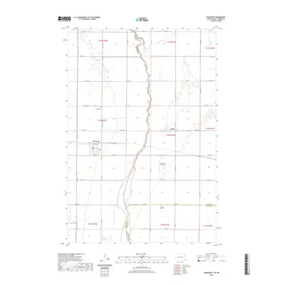
2020 Map of Fairmount
USGS Topo · Published 2020About this map
Fairmount serves as the focal point of this northern plains landscape where the borders of North Dakota and Minnesota meet. The map reveals a transition from the agricultural grid of Richland County toward the winding course of the Bois de Sioux River, which serves as the state boundary line. To the north, the Rabbit River meanders across the state line, while the southern reaches are marked by the Judicial Ditch Number Eleven-Ten, illustrating the intensive water management required for regional farming. Local history is anchored by several burial sites, including Fairmount Cem, Calvary Cem, and Pleasant Hill Cem, alongside the small settlement of Childs. The presence of the Wetherbee Farm Airport highlights the intersection of aviation and agriculture in this open prairie environment.
Find a feature on this map
53 named features on this map. Tap any name to fly to it.
Don’t see what you’re looking for? This feature index may not catch every label — zoom into the map to look around manually.
Map Details
Editions of this 2020 Fairmount Map
This is the sole edition of this map. No revisions or reprints were ever made.
Other maps of this area

1904 · Wahpeton
USGS Topo · 1:125,000

1915 · White Rock
USGS Topo · 1:62,500

1918 · White Rock
USGS Topo · 1:62,500

1951 · Wheaton
USGS Topo · 1:62,500

1951 · Campbell
USGS Topo · 1:62,500

1953 · Milbank
USGS Topo · 1:250,000

1953 · Fargo
USGS Topo · 1:250,000

1956 · Fargo
USGS Topo · 1:250,000

1958 · Milbank
USGS Topo · 1:250,000

1964 · Fairmount NW
USGS Topo · 1:24,000