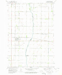
1973 Map of Fairmount
USGS Topo · Published 1975About this map
The Bois De Sioux River marks the winding border between North Dakota and Minnesota, defining the eastern edge of this agricultural landscape. Centered around the town of Fairmount, the area is heavily shaped by its rail history, serving as a junction for both the Soo Line and the Chicago Milwaukee St Paul and Pacific railroads. These lines cross the flat prairie, which is intricately managed by a network of drainage infrastructure such as County Ditch No 26 and Judicial Ditch No 11. Local life is anchored by small outposts like Childs and Foss, and spiritual and genealogical landmarks including Calvary Cem and St Pauls Ch. The presence of the Miller Landing Strip highlights the vast distances of the Red River Valley, where small-scale aviation and industrial agriculture coexist along the banks of the Rabbit River.
Find a feature on this map
32 named features on this map. Tap any name to fly to it.
Don’t see what you’re looking for? This feature index may not catch every label — zoom into the map to look around manually.
Map Details
Editions of this 1973 Fairmount Map
This is the sole edition of this map. No revisions or reprints were ever made.
Other maps of this area

1904 · Wahpeton
USGS Topo · 1:125,000

1915 · White Rock
USGS Topo · 1:62,500

1918 · White Rock
USGS Topo · 1:62,500

1951 · Wheaton
USGS Topo · 1:62,500

1951 · Campbell
USGS Topo · 1:62,500

1953 · Milbank
USGS Topo · 1:250,000

1953 · Fargo
USGS Topo · 1:250,000

1956 · Fargo
USGS Topo · 1:250,000

1958 · Milbank
USGS Topo · 1:250,000

1964 · Fairmount NW
USGS Topo · 1:24,000