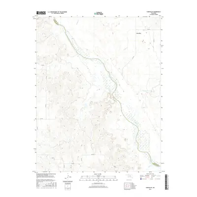
2016 Map of Fairvalley
USGS Topo · Published 2016About this map
The Cimarron River carves a wide path through this portion of Northwest Oklahoma, serving as the physical divide between Woods Co and Woodward Co. The landscape is defined by the river’s braided channels and the extensive network of drainage creeks that feed into its basin, including Redhorse Cr, Wildcat Cr, and Whitehorse Cr. Located in the northeast corner of the map, the small community of Fairvalley is the primary point of settlement, connected to the surrounding countryside by a grid of rural roads such as Grant Rd and Co Rd 250. The topography here shows the transition from flat upland plains into the eroded breaks and hillsides that slope toward the river valley. This 2016 survey documents the modern layout of sections and section lines that have structured these high plains since the era of original settlement and land runs.
Find a feature on this map
22 named features on this map. Tap any name to fly to it.
Don’t see what you’re looking for? This feature index may not catch every label — zoom into the map to look around manually.
Map Details
Editions of this 2016 Fairvalley Map
This is the sole edition of this map. No revisions or reprints were ever made.
Other maps of this area

1955 · Woodward
USGS Topo · 1:250,000

1958 · Woodward
USGS Topo · 1:250,000

1969 · Waynoka NW
USGS Topo · 1:24,000

1969 · Tegarden
USGS Topo · 1:24,000

1969 · Waynoka West
USGS Topo · 1:24,000

1970 · Fairvalley SW
USGS Topo · 1:24,000

1970 · Alabaster Caverns
USGS Topo · 1:24,000

1970 · Fairvalley SE
USGS Topo · 1:24,000

1970 · Fairvalley
USGS Topo · 1:24,000

1970 · Edith
USGS Topo · 1:24,000