
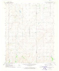
1970 Map of Fairvalley SW
USGS Topo · Published 1972About this map
Long Creek and Doe Creek carve through the north-central Oklahoma terrain on this 1970s survey, revealing a landscape defined by natural drainage and industrial infrastructure. The area is marked by the expansive Oil and Gas Field, indicating the mid-century energy production that shaped Woodward County's rural economy. Evidence of local utility and transport is found in the Pipeline corridors, a remote Pumping Station, and a private Landing Strip, reflecting the logistical needs of remote oil operations. The map also identifies a Caliche Pit, a resource essential for surfacing the network of section-line roads that segment the townships of Union, Mooreland, and Liberty. This document preserves the intersection of traditional ranching boundaries, shown by fine red dashed lines, with the intensifying development of the regional oil and gas industry.
Find a feature on this map
17 named features on this map. Tap any name to fly to it.
Don’t see what you’re looking for? This feature index may not catch every label — zoom into the map to look around manually.
Map Details
Editions of this 1970 Fairvalley SW Map
This is the sole edition of this map. No revisions or reprints were ever made.
Other maps of this area

1955 · Woodward
USGS Topo · 1:250,000

1958 · Woodward
USGS Topo · 1:250,000

1969 · Quinlan
USGS Topo · 1:24,000

1969 · Mooreland
USGS Topo · 1:24,000

1969 · Woodward NE
USGS Topo · 1:24,000

1970 · Alabaster Caverns
USGS Topo · 1:24,000

1970 · Fairvalley SE
USGS Topo · 1:24,000

1970 · Fairvalley
USGS Topo · 1:24,000

1970 · Sleeping Bear Creek SE
USGS Topo · 1:24,000
1971 · Sleeping Bear Creek
USGS Topo · 1:24,000