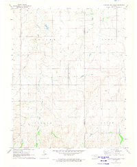
1971 Map of Sleeping Bear Creek
USGS Topo · Published 1973About this map
Sleeping Bear Creek and its southern tributaries define the topography of this rural landscape along the boundary of Harper and Woodward counties. In the early 1970s, the area was characterized by a distinct pattern of townships including Saline, Penn, Center, and Union. The map records the infrastructure of the Oklahoma energy industry, noting multiple locations for a Gas Well, a Drill Hole, and a prominent Pipeline crossing the terrain. Local history and genealogy are anchored by a rural Cem and the winding course of Traders Creek. The network of section lines and the prominent Traders road illustrate the transition of the land from open range to a structured agricultural and industrial grid.
Find a feature on this map
14 named features on this map. Tap any name to fly to it.
Don’t see what you’re looking for? This feature index may not catch every label — zoom into the map to look around manually.
Map Details
Editions of this 1971 Sleeping Bear Creek Map
This is the sole edition of this map. No revisions or reprints were ever made.
Other maps of this area

1955 · Woodward
USGS Topo · 1:250,000

1958 · Woodward
USGS Topo · 1:250,000

1970 · Fairvalley SW
USGS Topo · 1:24,000

1970 · Alabaster Caverns
USGS Topo · 1:24,000

1970 · Edith
USGS Topo · 1:24,000

1970 · Sleeping Bear Creek SW
USGS Topo · 1:24,000

1970 · Sleeping Bear Creek NW
USGS Topo · 1:24,000

1970 · Sleeping Bear Creek SE
USGS Topo · 1:24,000

1971 · Selman SE
USGS Topo · 1:24,000

1971 · Selman
USGS Topo · 1:24,000