
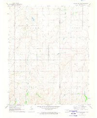
1971 Map of Selman SE
USGS Topo · Published 1973About this map
The Cimarron River and its braided channels dictate the geography of this northwestern Oklahoma landscape, where the borders of Harper, Woods, and Woodward Counties converge. In the early 1970s, this area remained defined by its hydraulic and rail networks, most notably the Atchison Topeka and Santa Fe railroad corridor that runs south of the river. The map reveals a rural economy transitioning from traditional agriculture toward resource extraction, evidenced by several Gas Wells and Gravel Pits scattered near Buffalo Creek.
Find a feature on this map
23 named features on this map. Tap any name to fly to it.
Don’t see what you’re looking for? This feature index may not catch every label — zoom into the map to look around manually.
Map Details
Editions of this 1971 Selman SE Map
This is the sole edition of this map. No revisions or reprints were ever made.
Other maps of this area

1955 · Woodward
USGS Topo · 1:250,000

1958 · Woodward
USGS Topo · 1:250,000

1970 · Alabaster Caverns
USGS Topo · 1:24,000

1970 · Lookout
USGS Topo · 1:24,000

1970 · Freedom NW
USGS Topo · 1:24,000

1970 · Edith
USGS Topo · 1:24,000

1970 · Selman NW
USGS Topo · 1:24,000

1970 · Sleeping Bear Creek NW
USGS Topo · 1:24,000

1971 · Selman
USGS Topo · 1:24,000
1971 · Sleeping Bear Creek
USGS Topo · 1:24,000