
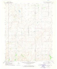
1970 Map of Sleeping Bear Creek SW
USGS Topo · Published 1973About this map
The North Canadian River meanders across this landscape during the early 1970s, carving a winding path through the borderlands of Harper and Woodward Counties. This area reflects a quiet, rural character focused on land use and small-scale infrastructure. Religious and social centers like the Rock Church Cem and the Community Hall suggest a dispersed but connected farming community. Industrial activity is indicated by a network of pipelines and a designated Gas Well, pointing toward the energy production that defines much of this Oklahoma region. The presence of the Missouri - Kansas - Texas rail line provides a glimpse into the transportation corridor that supported the local economy. The terrain, marked by Center and Woodward labels, shows the natural drainage patterns and topographical shifts typical of the plains.
Find a feature on this map
10 named features on this map. Tap any name to fly to it.
Don’t see what you’re looking for? This feature index may not catch every label — zoom into the map to look around manually.
Map Details
Editions of this 1970 Sleeping Bear Creek SW Map
This is the sole edition of this map. No revisions or reprints were ever made.
Other maps of this area

1955 · Woodward
USGS Topo · 1:250,000

1958 · Woodward
USGS Topo · 1:250,000

1969 · Fargo
USGS Topo · 1:24,000

1969 · Woodward
USGS Topo · 1:24,000

1969 · Woodward NE
USGS Topo · 1:24,000

1970 · Sleeping Bear Creek NW
USGS Topo · 1:24,000

1970 · Sleeping Bear Creek SE
USGS Topo · 1:24,000

1971 · Fort Supply
USGS Topo · 1:24,000

1971 · Fort Supply NE
USGS Topo · 1:24,000
1971 · Sleeping Bear Creek
USGS Topo · 1:24,000