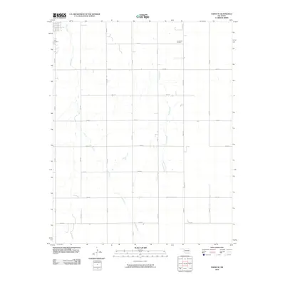
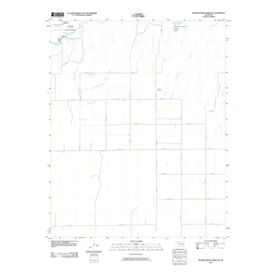
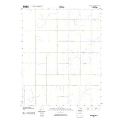
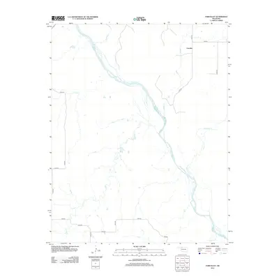
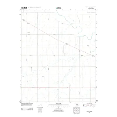
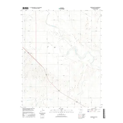
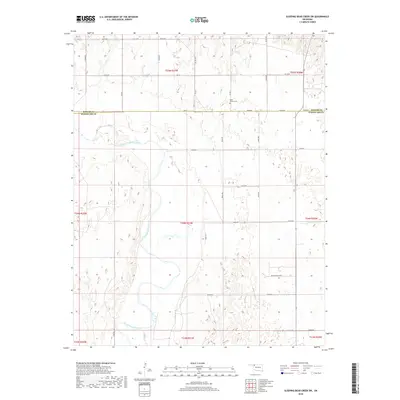
1970 Map of Sleeping Bear Creek SE
USGS Topo · Published 1973About this map
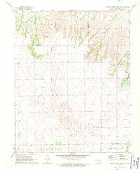
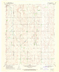
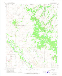
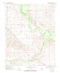
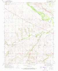
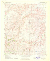
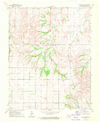
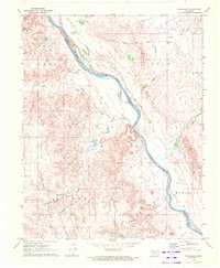
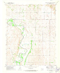
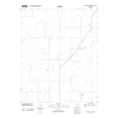
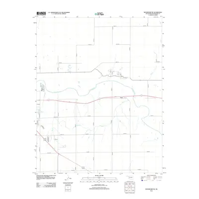
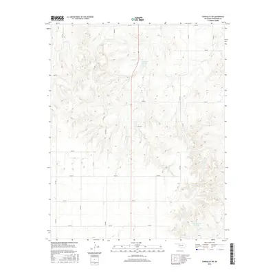
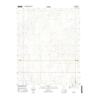
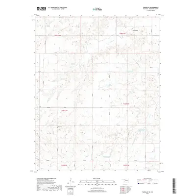
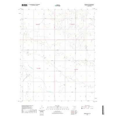
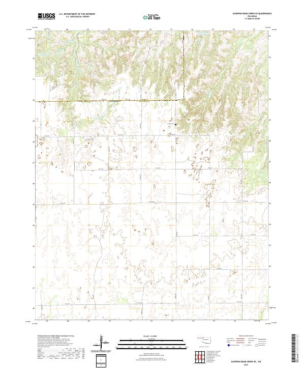
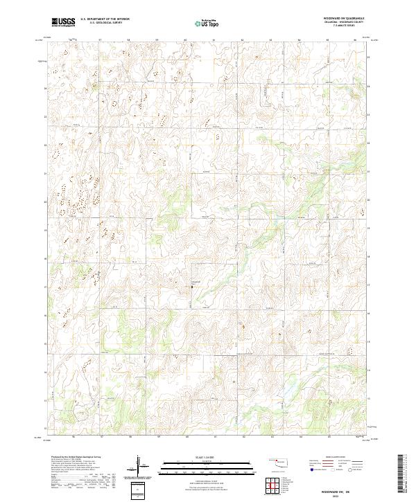
Harper Co Woodward Co boundary lines divide this landscape of western Oklahoma, where the drainage systems of Sleeping Bear Creek and Traders Creek carve distinctive patterns through the terrain. The map captures a primarily rural environment defined by the administrative townships of Center, Union, and Woodward. Industrial infrastructure is notably present through a network of pipelines and several oil wells, reflecting the region's energy production in the early 1970s. Local history is anchored at the Lathrop Cem and marked by modern communication markers like the Radio Tower. The southern portion of the sheet introduces the northern edge of Mooreland, providing a detailed view of the section lines and rural infrastructure that defined this high plains landscape at the time of the survey.
Find a feature on this map
11 named features on this map. Tap any name to fly to it.
Don’t see what you’re looking for? This feature index may not catch every label — zoom into the map to look around manually.
Map Details
Editions of this 1970 Sleeping Bear Creek SE Map
This is the sole edition of this map. No revisions or reprints were ever made.
Historical Maps of Woodward County Through Time
78 maps found
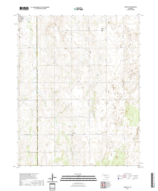
1969 Fargo SE
Woodward County, OK
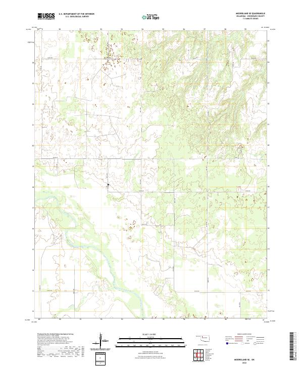
1969 Mooreland SE
Woodward County, OK
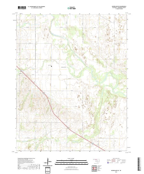
1969 Mooreland SW
Woodward County, OK
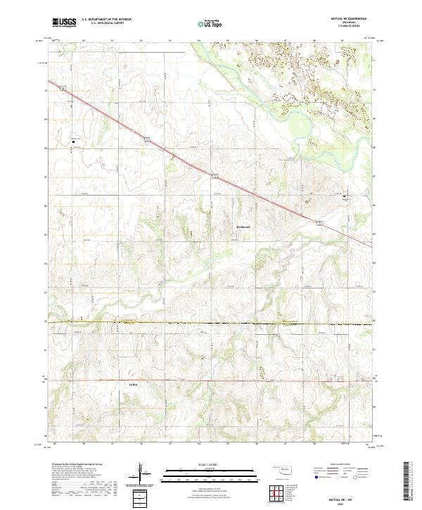
1969 Mutual NE
Woodward County, OK
1969 Vici NW
Woodward County, OK
1969 Woodward NE
Woodward County, OK
1969 Woodward SW
Woodward County, OK

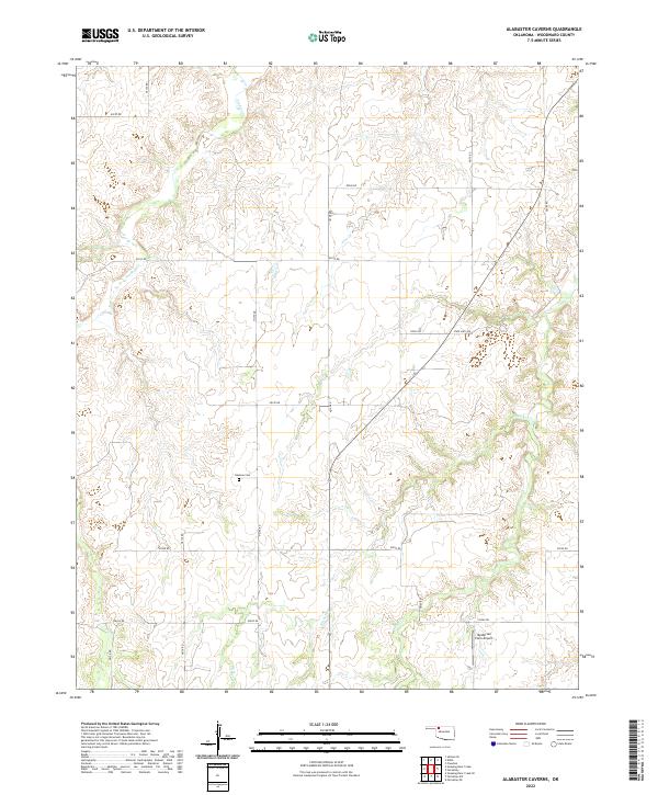
1970 Alabaster Caverns
Woodward County, OK
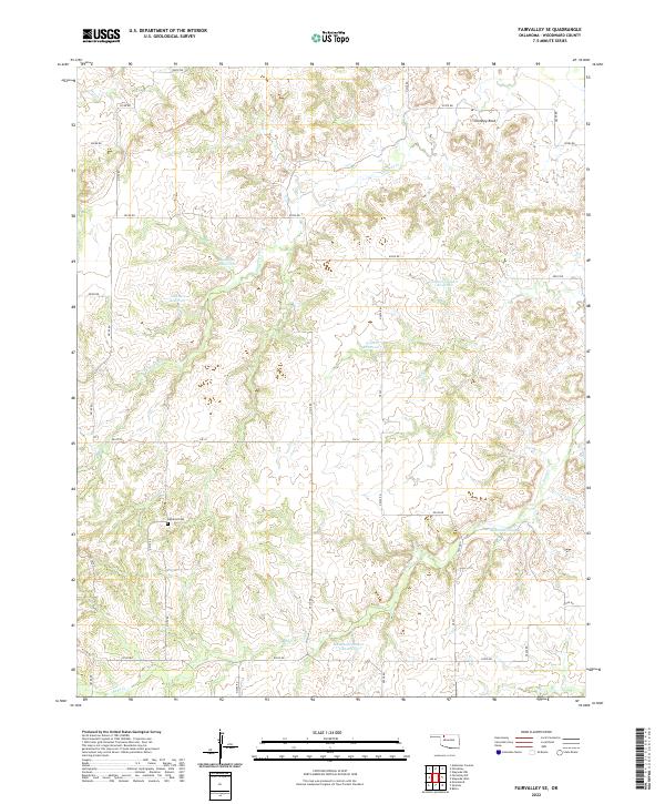
1970 Fairvalley SE
Woodward County, OK
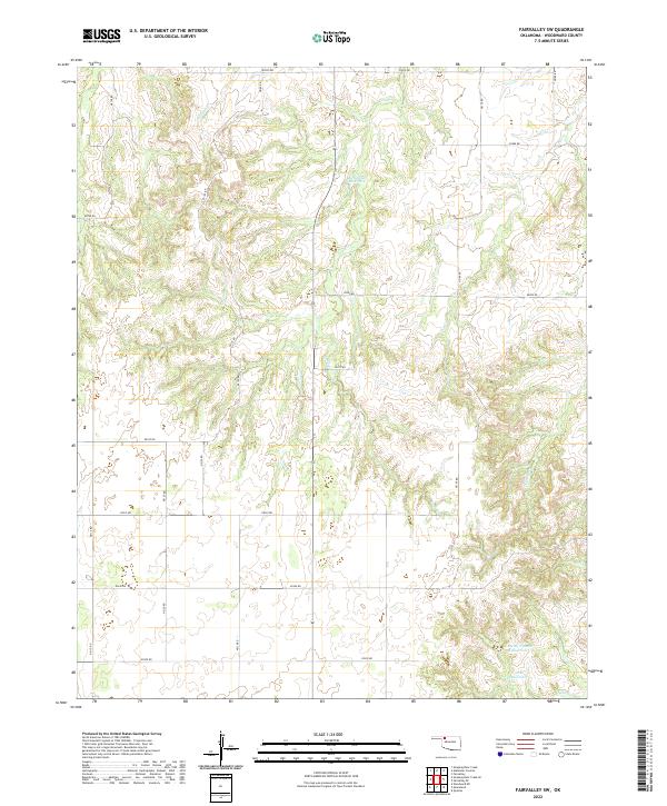
1970 Fairvalley SW
Woodward County, OK
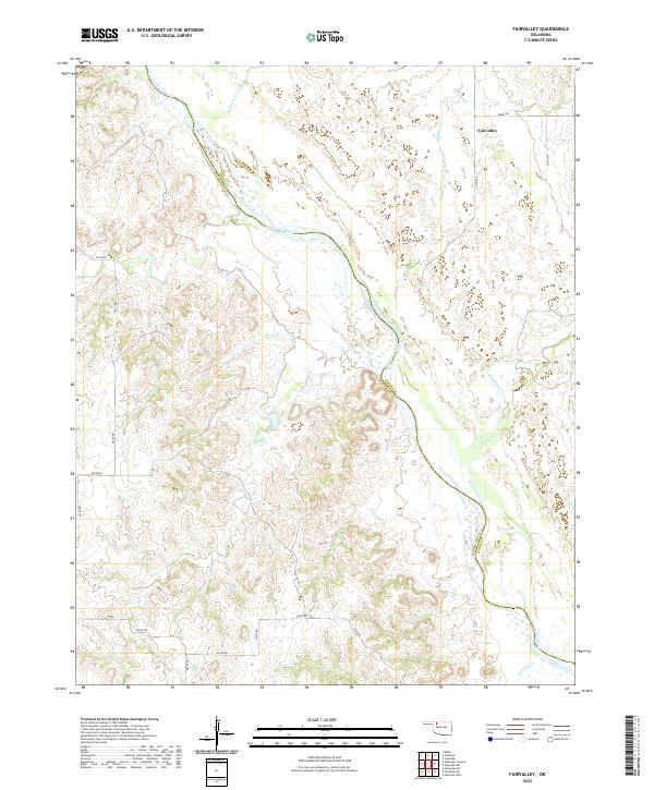
1970 Fairvalley
Woodward County, OK
1970 Sleeping Bear Creek SE
Woodward County, OK
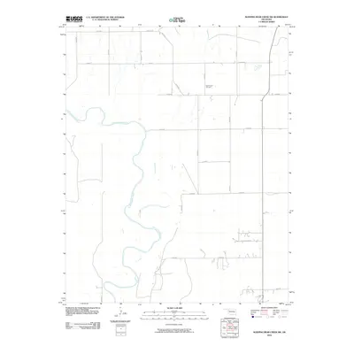
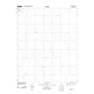
1970 Sleeping Bear Creek SW
Woodward County, OK
2010 Alabaster Caverns
Woodward County, OK
2010 Fairvalley SE
Woodward County, OK
2010 Fairvalley SW
Woodward County, OK
2010 Fairvalley
Woodward County, OK
2010 Fargo SE
Woodward County, OK
2010 Mooreland SE
Woodward County, OK
2010 Mooreland SW
Woodward County, OK
2010 Mutual NE
Woodward County, OK
2010 Sleeping Bear Creek SE
Woodward County, OK
2010 Sleeping Bear Creek SW
Woodward County, OK
2010 Vici NW
Woodward County, OK
2010 Woodward NE
Woodward County, OK
2010 Woodward SW
Woodward County, OK
2012 Alabaster Caverns
Woodward County, OK
2012 Fairvalley SE
Woodward County, OK
2012 Fairvalley SW
Woodward County, OK
2012 Fairvalley
Woodward County, OK
2012 Fargo SE
Woodward County, OK
2012 Mooreland SE
Woodward County, OK
2012 Mooreland SW
Woodward County, OK
2012 Mutual NE
Woodward County, OK
2012 Sleeping Bear Creek SE
Woodward County, OK
2012 Sleeping Bear Creek SW
Woodward County, OK
2012 Vici NW
Woodward County, OK
2012 Woodward NE
Woodward County, OK
2012 Woodward SW
Woodward County, OK
2016 Alabaster Caverns
Woodward County, OK
2016 Fairvalley SE
Woodward County, OK
2016 Fairvalley SW
Woodward County, OK
2016 Fairvalley
Woodward County, OK
2016 Fargo SE
Woodward County, OK
2016 Mooreland SE
Woodward County, OK
2016 Mooreland SW
Woodward County, OK
2016 Mutual NE
Woodward County, OK
2016 Sleeping Bear Creek SE
Woodward County, OK
2016 Sleeping Bear Creek SW
Woodward County, OK
2016 Vici NW
Woodward County, OK
2016 Woodward NE
Woodward County, OK
2016 Woodward SW
Woodward County, OK
2018 Alabaster Caverns
Woodward County, OK
2018 Fairvalley SE
Woodward County, OK
2018 Fairvalley SW
Woodward County, OK
2018 Fairvalley
Woodward County, OK
2018 Fargo SE
Woodward County, OK
2018 Mooreland SE
Woodward County, OK
2018 Mooreland SW
Woodward County, OK
2018 Mutual NE
Woodward County, OK
2018 Sleeping Bear Creek SE
Woodward County, OK
2018 Sleeping Bear Creek SW
Woodward County, OK
2018 Vici NW
Woodward County, OK
2018 Woodward NE
Woodward County, OK
2018 Woodward SW
Woodward County, OK
2022 Alabaster Caverns
Woodward County, OK
2022 Fairvalley SE
Woodward County, OK
2022 Fairvalley SW
Woodward County, OK
2022 Fairvalley
Woodward County, OK
2022 Fargo SE
Woodward County, OK
2022 Mooreland SE
Woodward County, OK
2022 Mooreland SW
Woodward County, OK
2022 Mutual NE
Woodward County, OK
2022 Sleeping Bear Creek SE
Woodward County, OK
2022 Sleeping Bear Creek SW
Woodward County, OK
2022 Vici NW
Woodward County, OK
2022 Woodward NE
Woodward County, OK
2022 Woodward SW
Woodward County, OK