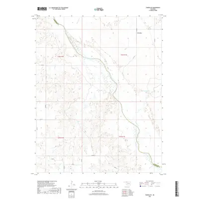
2018 Map of Fairvalley
USGS Topo · Published 2018About this map
The Cimarron River winds through the heart of the northern Oklahoma plains, carving a wide path across the landscape near the Fairvalley settlement. This 2018 survey illustrates the complex drainage network of northwestern Woods County, where numerous seasonal and perennial streams like Whitehorse Cr, Redhorse Cr, and Wildcat Cr converge toward the river valley. The map documents the persistent rural grid of county roads, including Grant Rd and Co Rd 240, which navigate the elevation changes between the river basin and the surrounding uplands. At the southern edge of the quadrangle, the Woods Co Woodward Co boundary is established near the banks of Chimney Cr, marking a transition in local jurisdiction. The topographic detail highlights the distinctive drainage patterns of the region, from the narrow draws of Doe Cr to the broader alluvial plains of the main river corridor.
Find a feature on this map
26 named features on this map. Tap any name to fly to it.
Don’t see what you’re looking for? This feature index may not catch every label — zoom into the map to look around manually.
Map Details
Editions of this 2018 Fairvalley Map
This is the sole edition of this map. No revisions or reprints were ever made.
Other maps of this area

1955 · Woodward
USGS Topo · 1:250,000

1958 · Woodward
USGS Topo · 1:250,000

1969 · Waynoka NW
USGS Topo · 1:24,000

1969 · Tegarden
USGS Topo · 1:24,000

1969 · Waynoka West
USGS Topo · 1:24,000

1970 · Fairvalley SW
USGS Topo · 1:24,000

1970 · Alabaster Caverns
USGS Topo · 1:24,000

1970 · Fairvalley SE
USGS Topo · 1:24,000

1970 · Fairvalley
USGS Topo · 1:24,000

1970 · Edith
USGS Topo · 1:24,000