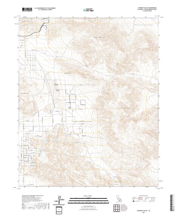
2021 Map of Fairview Valley
USGS Topo · Published 2021About this map
Fairview Dry Lake sits at the heart of this high-desert landscape, where the flat expanse of Fairview Valley is framed by prominent peaks. To the north and east, the Sidewinder Mtn, Black Mtn, and the Granite Mountains create a formidable natural boundary. The presence of several water sources in this arid environment, including Quail Spring, Isabelle Spring, and Amaral Spring, points to the traditional importance of these locations for transit and local survival.
Find a feature on this map
67 named features on this map. Tap any name to fly to it.
Don’t see what you’re looking for? This feature index may not catch every label — zoom into the map to look around manually.
Map Details
Editions of this 2021 Fairview Valley Map
This is the sole edition of this map. No revisions or reprints were ever made.
Other maps of this area

1901 · Southern California Sheet No. 1
USGS Topo · 1:250,000

1902 · Deep Creek
USGS Topo · 1:62,500

1902 · San Gorgonio
USGS Topo · 1:125,000

1904 · Southern California Sheet No. 1
USGS Topo · 1:250,000

1932 · Barstow
USGS Topo · 1:125,000

1934 · Barstow
USGS Topo · 1:125,000

1947 · Lucerne Valley
USGS Topo · 1:62,500

1949 · Lucerne Valley
USGS Topo · 1:62,500

1953 · San Bernardino
USGS Topo · 1:250,000

1955 · Ord Mountains
USGS Topo · 1:62,500