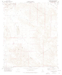
1970 Map of Fairview Valley
USGS Topo · Published 1975About this map
Sidewinder Mountain and the Granite Mountains dominate this high-desert landscape in the early 1970s. Industrial activity is concentrated at the base of Black Mountain, where a significant Cement Plant is connected by elaborate conveyors to nearby quarries. This network of infrastructure underscores the region's reliance on mineral extraction, a theme reinforced by the presence of the Red Top Mine and scattered prospects throughout the rocky terrain.
Find a feature on this map
32 named features on this map. Tap any name to fly to it.
Don’t see what you’re looking for? This feature index may not catch every label — zoom into the map to look around manually.
Map Details
Editions of this 1970 Fairview Valley Map
This is the sole edition of this map. No revisions or reprints were ever made.
Other maps of this area

1901 · Southern California Sheet No. 1
USGS Topo · 1:250,000

1902 · Deep Creek
USGS Topo · 1:62,500

1902 · San Gorgonio
USGS Topo · 1:125,000

1904 · Southern California Sheet No. 1
USGS Topo · 1:250,000

1932 · Barstow
USGS Topo · 1:125,000

1934 · Barstow
USGS Topo · 1:125,000

1947 · Lucerne Valley
USGS Topo · 1:62,500

1949 · Lucerne Valley
USGS Topo · 1:62,500

1953 · San Bernardino
USGS Topo · 1:250,000

1955 · Ord Mountains
USGS Topo · 1:62,500