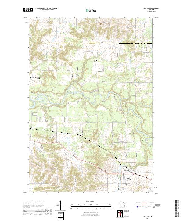
2022 Map of Fall Creek
USGS Topo · Published 2022About this map
Fall Creek sits at the confluence of several vital waterways in the central Wisconsin landscape of the early 21st century. The village is positioned at the junction of the Union Pacific Railroad and the winding course of Fall Cr, just south of the Eau Claire River. This area is characterized by distinct topographical features such as Fall Creek Valley and Pumpkin Valley, which define the local drainage patterns for tributaries like Ninemile Cr and Deinhammer Cr.
Find a feature on this map
58 named features on this map. Tap any name to fly to it.
Don’t see what you’re looking for? This feature index may not catch every label — zoom into the map to look around manually.
Map Details
Editions of this 2022 Fall Creek Map
This is the sole edition of this map. No revisions or reprints were ever made.
Other maps of this area

1927 · Strum
USGS Topo · 1:62,500

1930 · Strum
USGS Topo · 1:62,500

1934 · Chippewa Falls
USGS Topo · 1:62,500

1935 · Osseo
USGS Topo · 1:48,000

1936 · Chippewa Falls
USGS Topo · 1:62,500

1940 · Osseo
USGS Topo · 1:62,500

1952 · Cadott
USGS Topo · 1:62,500

1953 · Eau Claire
USGS Topo · 1:250,000

1958 · Eau Claire
USGS Topo · 1:250,000

1964 · Eau Claire
USGS Topo · 1:250,000