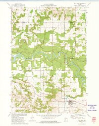
1972 Map of Fall Creek
USGS Topo · Published 1975About this map
The Eau Claire River defines the central geography of this Chippewa Valley landscape, flowing past Big Falls and the County Youth Camp as it moves toward the city of Eau Claire. In the early 1970s, the village of Fall Creek served as a local hub for the surrounding agricultural townships of Washington, Lincoln, and Seymour. The village is centered on the Chicago and North Western rail line, with landmarks like the Water Tank, Sewage Disposal plant, and Trinity Cem marking its perimeter.
Find a feature on this map
37 named features on this map. Tap any name to fly to it.
Don’t see what you’re looking for? This feature index may not catch every label — zoom into the map to look around manually.
Map Details
Editions of this 1972 Fall Creek Map
This is the sole edition of this map. No revisions or reprints were ever made.
Other maps of this area

1927 · Strum
USGS Topo · 1:62,500

1930 · Strum
USGS Topo · 1:62,500

1934 · Chippewa Falls
USGS Topo · 1:62,500

1935 · Osseo
USGS Topo · 1:48,000

1936 · Chippewa Falls
USGS Topo · 1:62,500

1940 · Osseo
USGS Topo · 1:62,500

1952 · Cadott
USGS Topo · 1:62,500

1953 · Eau Claire
USGS Topo · 1:250,000

1958 · Eau Claire
USGS Topo · 1:250,000

1964 · Eau Claire
USGS Topo · 1:250,000