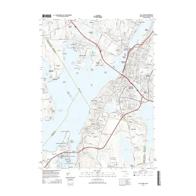
2015 Map of Fall River
USGS Topo · Published 2015About this map
Fall River sits as the industrial and cultural heart of this coastal region, where the Quequechan River meets the Taunton River. The map documents a dense urban landscape defined by established neighborhoods like Flint Village, Globe Village, and Mechanicsville, alongside significant maritime landmarks such as Battleship Cove and the Braga Bridge. This 2015 survey reveals how historical industrial sites and modern commerce, represented by Harbour Mall, coexist near the water's edge.
Find a feature on this map
101 named features on this map. Tap any name to fly to it.
Don’t see what you’re looking for? This feature index may not catch every label — zoom into the map to look around manually.
Map Details
Editions of this 2015 Fall River Map
This is the sole edition of this map. No revisions or reprints were ever made.
Other maps of this area

1885 · Taunton
USGS Topo · 1:62,500

1887 · Providence
USGS Topo · 1:62,500

1888 · Fall River
USGS Topo · 1:62,500

1888 · Taunton
USGS Topo · 1:62,500

1889 · Providence
USGS Topo · 1:62,500

1890 · Narragansett Bay
USGS Topo · 1:62,500

1892 · Narragansett Bay
USGS Topo · 1:62,500

1893 · Taunton
USGS Topo · 1:62,500

1893 · Fall River
USGS Topo · 1:62,500

1894 · Providence
USGS Topo · 1:62,500