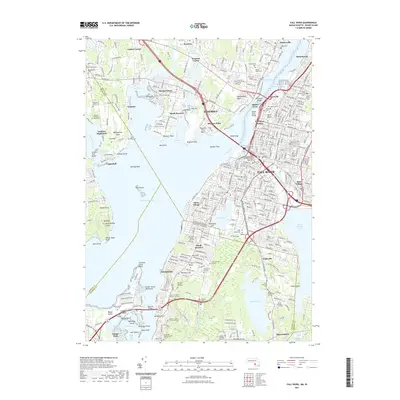
2021 Map of Fall River
USGS Topo · Published 2021About this map
The Taunton River and its various inlets dominate this coastal landscape, where the urban density of Fall River meets the bay. The map illustrates a complex network of industrial and residential development concentrated around the Quequechan River and Cook Pond, transitioning into the more suburban and rural reaches of Somerset and Tiverton. For those tracing family history, the area is exceptionally dense with burial sites, from large municipal grounds like the North Burial Ground and Oak Grove Cem to numerous small family plots such as the Benjamin Borden Lot Cem and the Honorable Thomas Durfee Lot Cem. Transportation infrastructure defines the shoreline, including the Fall River Station and historical crossings at Slades Ferry. The topography also notes cultural landmarks like King Phillips Chair on Mt Hope, reflecting the deep layers of heritage along these tidal waters.
Find a feature on this map
217 named features on this map. Tap any name to fly to it.
Don’t see what you’re looking for? This feature index may not catch every label — zoom into the map to look around manually.
Map Details
Editions of this 2021 Fall River Map
This is the sole edition of this map. No revisions or reprints were ever made.
Other maps of this area

1885 · Taunton
USGS Topo · 1:62,500

1887 · Providence
USGS Topo · 1:62,500

1888 · Fall River
USGS Topo · 1:62,500

1888 · Taunton
USGS Topo · 1:62,500

1889 · Providence
USGS Topo · 1:62,500

1890 · Narragansett Bay
USGS Topo · 1:62,500

1892 · Narragansett Bay
USGS Topo · 1:62,500

1893 · Taunton
USGS Topo · 1:62,500

1893 · Fall River
USGS Topo · 1:62,500

1894 · Providence
USGS Topo · 1:62,500