Loading...
Loading map...2024 Map of Fall River
USGS Topo · Published 2024About this map
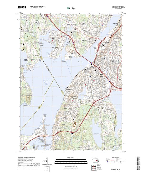
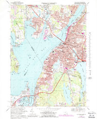
Fall River and its industrial surroundings are meticulously detailed on this survey, highlighting the complex shoreline where the Taunton Wild and Scenic River meets Mount Hope Bay. The city’s core is defined by the Quequechan River and major transport hubs like Fall River Station, while the cultural landscape is marked by a high density of historic cemeteries, including Friends Burial Ground and Oak Grove Cem.
Find a feature on this map
142 named features on this map. Tap any name to fly to it.
Don’t see what you’re looking for? This feature index may not catch every label — zoom into the map to look around manually.
Map Details
Date Portrayed2024
Date Published2024
PublisherU.S. Geological Survey
Map TypeTopographic
Scale1:24000
Physical Dimensions24 x 29 inches
Editions of this 2024 Fall River Map
This is the sole edition of this map. No revisions or reprints were ever made.
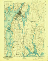
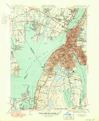
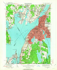
Historical Maps of Common Fence Point Through Time
9 maps found


Featured Locations
Source Details
SourceU.S. Geological Survey
CopyrightPublic Domain