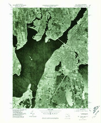
1977 Map of Fall River
USGS Topo · Published 1981About this map
Fall River serves as the industrial and urban anchor for this coastal region, where the Taunton River empties into the expansive Mount Hope Bay. This late-1970s orthophotoquad reveals the dense grid-pattern development of the city as it pushes eastward toward South Watuppa Pond, contrasting with the more suburban and wooded character of Swansea and Somerset to the west.
Find a feature on this map
12 named features on this map. Tap any name to fly to it.
Don’t see what you’re looking for? This feature index may not catch every label — zoom into the map to look around manually.
Map Details
Editions of this 1977 Fall River Map
This is the sole edition of this map. No revisions or reprints were ever made.
Other maps of this area

1885 · Taunton
USGS Topo · 1:62,500

1887 · Providence
USGS Topo · 1:62,500

1888 · Fall River
USGS Topo · 1:62,500

1888 · Taunton
USGS Topo · 1:62,500

1889 · Providence
USGS Topo · 1:62,500

1890 · Narragansett Bay
USGS Topo · 1:62,500

1892 · Narragansett Bay
USGS Topo · 1:62,500

1893 · Taunton
USGS Topo · 1:62,500

1893 · Fall River
USGS Topo · 1:62,500

1894 · Providence
USGS Topo · 1:62,500