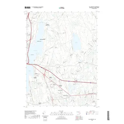
2018 Map of Fall River East
USGS Topo · Published 2018About this map
Fall River and the surrounding Bristol County countryside are defined by a network of expansive waterways and the institutional anchors of the late 20th century. Large bodies of water like Watuppa Pond, South Watuppa Pond, and the Copicut Reservoir dominate the landscape, separated by the thin land bridge of The Narrows. This area serves as a significant educational corridor, featuring both Bristol Community College and the Univ of Massachusetts Dartmouth campus near Cedar Dell Lake.
Find a feature on this map
140 named features on this map. Tap any name to fly to it.
Don’t see what you’re looking for? This feature index may not catch every label — zoom into the map to look around manually.
Map Details
Editions of this 2018 Fall River East Map
This is the sole edition of this map. No revisions or reprints were ever made.
Other maps of this area

1885 · New Bedford
USGS Topo · 1:62,500

1885 · Middleboro
USGS Topo · 1:62,500

1885 · Taunton
USGS Topo · 1:62,500

1888 · New Bedford
USGS Topo · 1:62,500

1888 · Fall River
USGS Topo · 1:62,500

1888 · Taunton
USGS Topo · 1:62,500

1888 · Middleboro
USGS Topo · 1:62,500

1893 · Taunton
USGS Topo · 1:62,500

1893 · Middleboro
USGS Topo · 1:62,500

1893 · Fall River
USGS Topo · 1:62,500