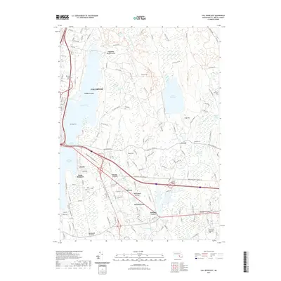
2021 Map of Fall River East
USGS Topo · Published 2021About this map
Watuppa Pond and South Watuppa Pond anchor the western edge of this landscape, separated by the narrow passage known as The Narrows. This area of Bristol County exhibits a transition from the urban reach of Fall River to the more dispersed hamlets of Hixville, Beulah Corners, and Westport Factory. The eastern half is defined by the significant conservation and water resources of Copicut Reservoir and the surrounding Copicut Swamp, which feed a network of waterways including Shingle Island River and the Copicut River. Local history is preserved in landmarks such as the Pine Island Cem and Evergreen Cem, while modern educational nodes like Bristol Community College and the University of Massachusetts Dartmouth indicate the region's contemporary development. Terrain features like Rolling Rock and Copicut Hill punctuate the landscape between established neighborhood corners.
Find a feature on this map
146 named features on this map. Tap any name to fly to it.
Don’t see what you’re looking for? This feature index may not catch every label — zoom into the map to look around manually.
Map Details
Editions of this 2021 Fall River East Map
This is the sole edition of this map. No revisions or reprints were ever made.
Other maps of this area

1885 · New Bedford
USGS Topo · 1:62,500

1885 · Middleboro
USGS Topo · 1:62,500

1885 · Taunton
USGS Topo · 1:62,500

1888 · New Bedford
USGS Topo · 1:62,500

1888 · Fall River
USGS Topo · 1:62,500

1888 · Taunton
USGS Topo · 1:62,500

1888 · Middleboro
USGS Topo · 1:62,500

1893 · Taunton
USGS Topo · 1:62,500

1893 · Middleboro
USGS Topo · 1:62,500

1893 · Fall River
USGS Topo · 1:62,500