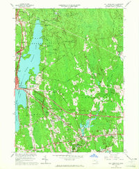
1963 Map of Fall River East
USGS Topo · Published 1965About this map
North Watuppa Pond and South Watuppa Pond anchor this 1963 survey, connected at the narrow strait known as The Narrows. This landscape transitions from the industrial periphery of Fall River to the wooded expanse of the Freetown Fall River State Forest. The map documents a network of named corners and small settlements like Hixville, Beulah Corners, and Westport Factory, each representing a distinct local hub of residency and industry.
Find a feature on this map
84 named features on this map. Tap any name to fly to it.
Don’t see what you’re looking for? This feature index may not catch every label — zoom into the map to look around manually.
Map Details
Editions of this 1963 Fall River East Map
This is the sole edition of this map. No revisions or reprints were ever made.
Other maps of this area

1885 · New Bedford
USGS Topo · 1:62,500

1885 · Middleboro
USGS Topo · 1:62,500

1885 · Taunton
USGS Topo · 1:62,500

1888 · New Bedford
USGS Topo · 1:62,500

1888 · Fall River
USGS Topo · 1:62,500

1888 · Taunton
USGS Topo · 1:62,500

1888 · Middleboro
USGS Topo · 1:62,500

1893 · Taunton
USGS Topo · 1:62,500

1893 · Middleboro
USGS Topo · 1:62,500

1893 · Fall River
USGS Topo · 1:62,500