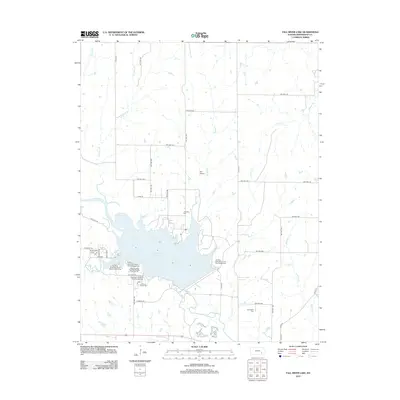
2012 Map of Fall River Lake
USGS Topo · Published 2012About this map
Fall River Lake dominates this Greenwood County landscape, where the waters of the Fall River are held by an extensive dam system. This 2012 survey illustrates the area's transition into a major recreational hub, featuring several established campsites including the Fall River State Park Casner Creek Campground and Fall River State Park Quarry Bay Campground. Beyond the modern park boundaries, the map preserves the locations of several community markers important to local genealogists, such as Township Cem and Charleston Cem. The surrounding terrain is defined by a network of drainage creeks like Badger Cr and Durham Cr, while the small Heir Airport sits just north of the lake's upper reaches. The grid of township highways, including TWP HWY 393 and TWP HWY 400, provides clear orientation for the rural tracts surrounding the reservoir.
Find a feature on this map
49 named features on this map. Tap any name to fly to it.
Don’t see what you’re looking for? This feature index may not catch every label — zoom into the map to look around manually.
Map Details
Editions of this 2012 Fall River Lake Map
This is the sole edition of this map. No revisions or reprints were ever made.
Other maps of this area

1885 · Eureka
USGS Topo · 1:125,000

1886 · Fredonia
USGS Topo · 1:125,000

1888 · Eureka
USGS Topo · 1:125,000

1894 · Fredonia
USGS Topo · 1:125,000

1894 · Eureka
USGS Topo · 1:125,000

1938 · Fredonia
USGS Topo · 1:62,500

1939 · Fredonia
USGS Topo · 1:48,000

1939 · Severy
USGS Topo · 1:62,500

1941 · Severy
USGS Topo · 1:62,500

1942 · Fredonia
USGS Topo · 1:62,500