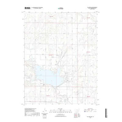
2018 Map of Fall River Lake
USGS Topo · Published 2018About this map
Fall River Lake dominates this Greenwood County landscape, where the Fall River was impounded to create a significant reservoir system. The map reveals the intricate shoreline and the surrounding network of recreational pathways, including the Blue Stem Trail, Cat Claw Trail, and Post-Oak Trail that navigate the varied elevations near the water. For those researching local history, the map preserves the locations of rural burials such as Browns Chapel Cem, Township Cem, and Charleston Cem, which serve as quiet markers of the area's agricultural past. Higher ground is noted at Lookout Pt, overlooking the drainage basins of Van Horn Branch and Badger Creek. The landscape is a mix of section-line roads like 60th St and more modern county routes, reflecting the evolution of transport in this corner of the Kansas prairie.
Find a feature on this map
51 named features on this map. Tap any name to fly to it.
Don’t see what you’re looking for? This feature index may not catch every label — zoom into the map to look around manually.
Map Details
Editions of this 2018 Fall River Lake Map
This is the sole edition of this map. No revisions or reprints were ever made.
Other maps of this area

1885 · Eureka
USGS Topo · 1:125,000

1886 · Fredonia
USGS Topo · 1:125,000

1888 · Eureka
USGS Topo · 1:125,000

1894 · Fredonia
USGS Topo · 1:125,000

1894 · Eureka
USGS Topo · 1:125,000

1938 · Fredonia
USGS Topo · 1:62,500

1939 · Fredonia
USGS Topo · 1:48,000

1939 · Severy
USGS Topo · 1:62,500

1941 · Severy
USGS Topo · 1:62,500

1942 · Fredonia
USGS Topo · 1:62,500