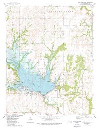
1975 Map of Fall River Lake
USGS Topo · Published 1978About this map
Fall River Lake dominates this mid-1970s landscape, illustrating a transition from the original watercourses of the Fall River to a managed reservoir system. The map documents the extensive State Wildlife Management Area and Fall River State Park, reflecting the era's focus on conservation and outdoor recreation. A legacy of early settlement persists through several burial grounds, including Browns Chapel Cem and Charleston Cem, while the small settlement of Martin stands near the northern boundary. Transportation and industry are marked by the St L-SF railroad line and a Landing Strip, alongside extractive sites like the Quarry near the Fall River dam. Natural features such as Salt Springs and Durham Creek provide context for the varied terrain surrounding the central reservoir.
Find a feature on this map
34 named features on this map. Tap any name to fly to it.
Don’t see what you’re looking for? This feature index may not catch every label — zoom into the map to look around manually.
Map Details
Editions of this 1975 Fall River Lake Map
This is the sole edition of this map. No revisions or reprints were ever made.
Other maps of this area

1885 · Eureka
USGS Topo · 1:125,000

1886 · Fredonia
USGS Topo · 1:125,000

1888 · Eureka
USGS Topo · 1:125,000

1894 · Fredonia
USGS Topo · 1:125,000

1894 · Eureka
USGS Topo · 1:125,000

1938 · Fredonia
USGS Topo · 1:62,500

1939 · Fredonia
USGS Topo · 1:48,000

1939 · Severy
USGS Topo · 1:62,500

1941 · Severy
USGS Topo · 1:62,500

1942 · Fredonia
USGS Topo · 1:62,500