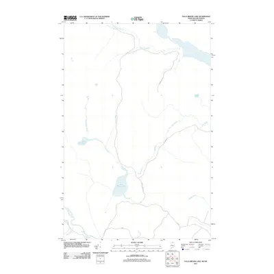
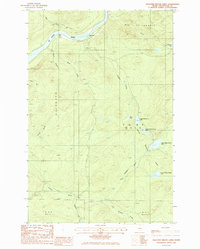
2011 Map of Falls Brook Lake
USGS Topo · Published 2011About this map
Glazier Lake dominates the northern border of this Maine landscape, where the waters of the Yankeetuladi Brook flow through a heavily forested drainage system. The terrain is defined by a dense network of waterways including Falls Brook and White Brook, which feed into the central Falls Brook Lake. This area of Aroostook County shows a landscape primarily shaped by timber management and natural hydrology, with limited infrastructure represented by timber roads like Lake Fall Brook Rd and Conners Cove Rd.
Find a feature on this map
17 named features on this map. Tap any name to fly to it.
Don’t see what you’re looking for? This feature index may not catch every label — zoom into the map to look around manually.
Map Details
Editions of this 2011 Falls Brook Lake Map
This is the sole edition of this map. No revisions or reprints were ever made.
Other maps of this area

1930 · Allagash
USGS Topo · 1:48,000

1930 · St Francis
USGS Topo · 1:48,000

1933 · Allagash
USGS Topo · 1:62,500

1933 · St Francis
USGS Topo · 1:62,500

1955 · Beau Lake
USGS Topo · 1:62,500

1962 · Edmundston
USGS Topo · 1:250,000
1975 · St Francis SW
USGS Topo · 1:24,000
1975 · St Francis NW
USGS Topo · 1:24,000
1985 · St. Francis
USGS Topo · 1:24,000
1985 · Pelletier Brook Lakes
USGS Topo · 1:24,000