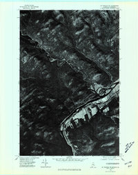
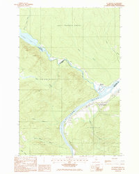
1975 Map of St Francis NW
USGS Topo · Published 1981About this map
The St. John River forms a winding international boundary through this northern landscape, captured in a mid-1970s orthophotoquad. The settlement of St Francis occupies the southern bank, where cleared agricultural fields create a sharp visual contrast against the dense, dark timberlands that dominate the surrounding terrain. This aerial perspective reveals the distinct land-use patterns along the border, where the river serves as the dividing line between Canada and the United States and specifically between New Brunswick and Maine. The map provides a unique structural view of the region's river-based development, showing how habitation and farming are concentrated strictly along the alluvial flats while the uplands remain heavily forested and undeveloped.
Find a feature on this map
4 named features on this map. Tap any name to fly to it.
Don’t see what you’re looking for? This feature index may not catch every label — zoom into the map to look around manually.
Map Details
Editions of this 1975 St Francis NW Map
This is the sole edition of this map. No revisions or reprints were ever made.
Other maps of this area

1930 · Allagash
USGS Topo · 1:48,000

1930 · St Francis
USGS Topo · 1:48,000

1933 · Allagash
USGS Topo · 1:62,500

1933 · St Francis
USGS Topo · 1:62,500

1955 · Beau Lake
USGS Topo · 1:62,500

1962 · Edmundston
USGS Topo · 1:250,000
1975 · St Francis SW
USGS Topo · 1:24,000
1975 · St Francis SE
USGS Topo · 1:24,000
1975 · St Francis NE
USGS Topo · 1:24,000
1985 · St. Francis
USGS Topo · 1:24,000