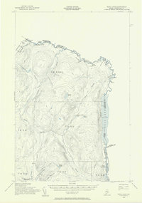
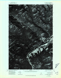
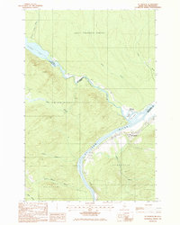
1955 Map of Beau Lake
USGS Topo · Published 1956About this map
Estcourt and Estcourt Station anchor the northernmost reaches of this Maine-Quebec border survey, where the international boundary cuts directly through the settlement. The landscape is defined by the winding course of the St Francis River, which feeds into the long, narrow expanse of Beau Lake. The map reveals a remote timberland interior accessed primarily by a network of labels marked Jeep Trail and Private roads, highlighting the region's historical reliance on logging and border commerce. Local landmarks such as the Customs Office near the St Francis River and the various water bodies like Yankeetuladi Pond and Jones Pond provide specific points of reference in a terrain dominated by significant peaks like Boat Landing Mountain and Hafer Mountain.
Find a feature on this map
36 named features on this map. Tap any name to fly to it.
Don’t see what you’re looking for? This feature index may not catch every label — zoom into the map to look around manually.
Map Details
Editions of this 1955 Beau Lake Map
2 editions found
Other maps of this area

1930 · Allagash
USGS Topo · 1:48,000

1930 · St Francis
USGS Topo · 1:48,000

1933 · Allagash
USGS Topo · 1:62,500
1933 · St Francis
USGS Topo · 1:62,500
1955 · Rocky Mountain
USGS Topo · 1:62,500

1955 · Rocky Brook
USGS Topo · 1:62,500

1962 · Edmundston
USGS Topo · 1:250,000
1975 · St Francis NW
USGS Topo · 1:24,000
1985 · St. Francis
USGS Topo · 1:24,000
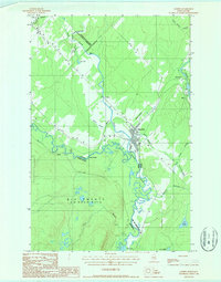
1986 · Landry
USGS Topo · 1:24,000
Featured Places
- Estcourt Station, Big Twenty Township
- Big Twenty Township, ME
- T19 R12 WELS, ME
- T18 R12 WELS, ME
- T18 R10 WELS, ME