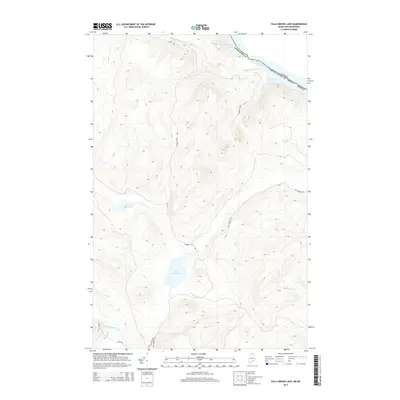
2014 Map of Falls Brook Lake
USGS Topo · Published 2014About this map
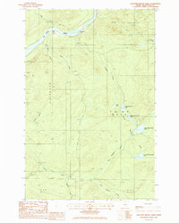
The St. Francis River forms the international boundary between Maine and Canada in this northern portion of Aroostook County. This 2014 survey documents a landscape of dense water networks and logging routes, defined by the drainage of Falls Brook Lake and Little Falls Pond. The interior is crisscrossed by a complex system of unpaved roads, including Fall Brook Rd and Conners Cove Rd, which facilitate movement through the heavily timbered hills. The presence of numerous named water bodies like Sowish Lake, McKeon Pond, and McPherson Pond reflects the glacial topography of the North Woods. Along the southern edge, the Little Black River meets Kelly Brook near Rapid Rd, highlighting the navigational importance of these waterways for transport and recreation in a region where seasonal roads provide the primary land access.
Find a feature on this map
20 named features on this map. Tap any name to fly to it.
Don’t see what you’re looking for? This feature index may not catch every label — zoom into the map to look around manually.
Map Details
Editions of this 2014 Falls Brook Lake Map
This is the sole edition of this map. No revisions or reprints were ever made.
Other maps of this area

1930 · Allagash
USGS Topo · 1:48,000

1930 · St Francis
USGS Topo · 1:48,000

1933 · Allagash
USGS Topo · 1:62,500

1933 · St Francis
USGS Topo · 1:62,500

1955 · Beau Lake
USGS Topo · 1:62,500

1962 · Edmundston
USGS Topo · 1:250,000
1975 · St Francis SW
USGS Topo · 1:24,000
1975 · St Francis NW
USGS Topo · 1:24,000
1985 · St. Francis
USGS Topo · 1:24,000
1985 · Pelletier Brook Lakes
USGS Topo · 1:24,000