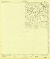
1931 Map of Falls City
USGS Topo · Published 1931About this map
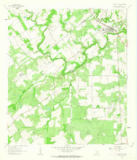
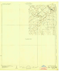
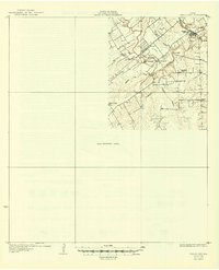
The San Antonio River carves a winding path through this corner of South Texas, defining the boundary between Wilson and Karnes Counties during the early 1930s. This preliminary edition, compiled in part from early aerial photography, centers on the rail-connected hub of Falls City along the Southern Pacific line. The landscape is dotted with rural identifiers of a ranching and farming era, including the distinct Froshinn Hall and several local educational landmarks like Laake Sch and Arnold Sch. Significant river features like Skiles Falls and the Mays Crossing waypoint suggest the historical importance of the river corridor for travel and trade. While much of the quadrangle remains an unsurveyed area, the captured portions provide a detailed look at settlements like Deweesville and the network of drainages such as Scared Dog Creek and Los Moras Creek.
Find a feature on this map
17 named features on this map. Tap any name to fly to it.
Don’t see what you’re looking for? This feature index may not catch every label — zoom into the map to look around manually.
Map Details
Editions of this 1931 Falls City Map
4 editions found
Historical Maps of Falls City Through Time
7 maps found