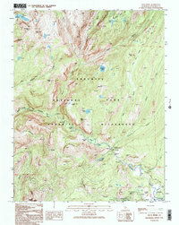
1992 Map of Falls Ridge
USGS Topo · Published 1995About this map
Glen Aulin serves as a central waypoint in this high-altitude wilderness, where the Tuolumne River descends through a series of dramatic water features. This 1992 provisional survey documents the hydraulic energy of the landscape, tracing the river's path from Tuolumne Falls and the White Cascade down through California Falls, Le Conte Falls, and the notable Waterwheel Falls. These features define the upper reaches of the Grand Canyon of the Tuolumne River, a geological corridor flanked by granite heights like Falls Ridge and Pothole Dome.
Find a feature on this map
37 named features on this map. Tap any name to fly to it.
Don’t see what you’re looking for? This feature index may not catch every label — zoom into the map to look around manually.
Map Details
Editions of this 1992 Falls Ridge Map
2 editions found
Other maps of this area

1896 · Dardanelles
USGS Topo · 1:125,000

1897 · Yosemite
USGS Topo · 1:125,000

1898 · Dardanelles
USGS Topo · 1:125,000

1900 · Yosemite
USGS Topo · 1:125,000

1901 · Mt. Lyell
USGS Topo · 1:125,000

1903 · Yosemite
USGS Topo · 1:125,000

1909 · Yosemite
USGS Topo · 1:125,000

1909 · Bridgeport
USGS Topo · 1:125,000

1911 · Bridgeport
USGS Topo · 1:125,000

1920 · Bridgeport
USGS Topo · 1:125,000