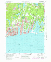
1972 Map of Falmouth
USGS Topo · Published 1979About this map
The coastal shelf of Cape Cod is defined by its deep salt-water inlets and numerous freshwater kettles like Coonamessett Pond and Long Pond. This 1970s revision shows the established town center of Falmouth alongside developing waterfront communities such as Mara Vista, Acapesket, and Menauhant. The local economy of the era is evident in the extensive Cranberry Bogs scattered throughout the north, particularly near the Crane Wildlife Management Area.
Find a feature on this map
100 named features on this map. Tap any name to fly to it.
Don’t see what you’re looking for? This feature index may not catch every label — zoom into the map to look around manually.
Map Details
Editions of this 1972 Falmouth Map
3 editions found
Other maps of this area

1886 · Falmouth
USGS Topo · 1:62,500

1887 · Marthas Vineyard
USGS Topo · 1:62,500

1888 · Barnstable
USGS Topo · 1:62,500

1888 · Falmouth
USGS Topo · 1:62,500

1889 · Marthas Vineyard
USGS Topo · 1:62,500

1893 · Barnstable
USGS Topo · 1:62,500

1893 · Falmouth
USGS Topo · 1:62,500

1894 · Marthas Vineyard
USGS Topo · 1:62,500

1915 · Falmouth
USGS Topo · 1:62,500

1920 · Falmouth
USGS Topo · 1:62,500