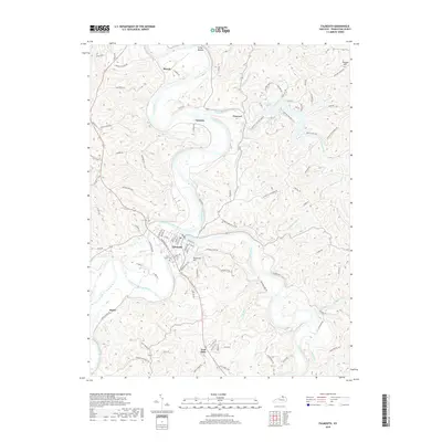
2019 Map of Falmouth
USGS Topo · Published 2019About this map
The Licking River and its South Fork converge at the historic town of Falmouth, the seat of Pendleton County. This landscape is defined by the winding river valley and the ridges that rise above it, including Reservoir Hill and Thomas Hill. To the south, the settlement of Four Oaks sits along the corridor of Old Us HWY 27, while north of town, the river creates a wide bend around Irving Bottom near Menzie. The map also captures several small communities like Catawba and Hayes, connected by a network of rural ridge-top roads such as Kennedy Ridge Rd and Maple Ridge Rd. In the northeastern corner, Kincaid Lake and its surrounding state park provide a significant recreational landmark, fed by Kincaid Creek and its northern and southern Little Kincaid branches. Local history is anchored at the Beech Grove Cemetery, situated on the southern edge of the main Falmouth settlement.
Find a feature on this map
95 named features on this map. Tap any name to fly to it.
Don’t see what you’re looking for? This feature index may not catch every label — zoom into the map to look around manually.
Map Details
Editions of this 2019 Falmouth Map
This is the sole edition of this map. No revisions or reprints were ever made.
Other maps of this area

1929 · Alexandria
USGS Topo · 1:48,000

1930 · Falmouth
USGS Topo · 1:48,000

1931 · Felicity
USGS Topo · 1:62,500

1936 · Alexandria
USGS Topo · 1:62,500

1936 · Falmouth
USGS Topo · 1:62,500

1952 · Berlin
USGS Topo · 1:24,000

1952 · Claysville
USGS Topo · 1:24,000

1953 · Berry
USGS Topo · 1:24,000

1953 · Kelat
USGS Topo · 1:24,000

1953 · Butler
USGS Topo · 1:24,000