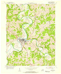
1954 Map of Falmouth
USGS Topo · Published 1955About this map
Falmouth serves as the hub of this Pendleton County landscape, situated at the dramatic confluence of the Licking River and the South Fork Licking River. The town's grid is bounded by the winding riverbanks and the Louisville and Nashville railroad line, which follows the river's serpentine path north toward Catawba and Menzie. The map captures a moment in the mid-1950s when the region's economy was deeply tied to these waterways and rail corridors, with evidence of local infrastructure like the Fairgrounds and the Gaging Sta along the riverbanks.
Find a feature on this map
23 named features on this map. Tap any name to fly to it.
Don’t see what you’re looking for? This feature index may not catch every label — zoom into the map to look around manually.
Map Details
Editions of this 1954 Falmouth Map
2 editions found
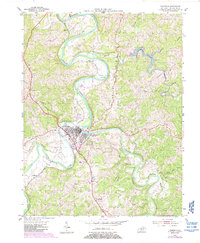
Other maps of this area

1929 · Alexandria
USGS Topo · 1:48,000

1930 · Falmouth
USGS Topo · 1:48,000

1931 · Felicity
USGS Topo · 1:62,500

1936 · Alexandria
USGS Topo · 1:62,500

1936 · Falmouth
USGS Topo · 1:62,500

1952 · Berlin
USGS Topo · 1:24,000

1952 · Claysville
USGS Topo · 1:24,000

1953 · Berry
USGS Topo · 1:24,000

1953 · Kelat
USGS Topo · 1:24,000

1953 · Butler
USGS Topo · 1:24,000