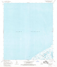
1968 Map of False Mouth Bayou
USGS Topo · Published 1969About this map
Lake Borgne dominates this coastal landscape, showing the expanse of the eastern St. Bernard Parish marshlands as they appeared in the late 1960s. The southeastern corner of the map reveals a fragile network of wetlands within the Biloxi State Wildlife Management Area, where the transition from open water to marsh is defined by tidal channels and interior basins. Coastal researchers and local historians can trace the specific courses of False Mouth Bayou and Magill Bayou as they drain into the lake. This survey, revised in 1968, preserves the intricate shoreline of the Lakes of Bayou Marron and the Magill Lagoon before decades of coastal erosion and subsidence further altered these waterways. A single Light serves as a navigational reference point in an otherwise undeveloped aquatic environment.
Find a feature on this map
7 named features on this map. Tap any name to fly to it.
Don’t see what you’re looking for? This feature index may not catch every label — zoom into the map to look around manually.
Map Details
Editions of this 1968 False Mouth Bayou Map
2 editions found
Other maps of this area

1893 · Rigolets
USGS Topo · 1:62,500

1893 · Shell Beach
USGS Topo · 1:62,500

1893 · Toulme
USGS Topo · 1:62,500

1895 · Bodreau
USGS Topo · 1:62,500

1935 · English Lookout
USGS Topo · 1:31,680

1935 · Grand Island Pass
USGS Topo · 1:31,680

1936 · Rigolets
USGS Topo · 1:62,500

1939 · Shell Beach
USGS Topo · 1:62,500

1941 · Shell Beach
USGS Topo · 1:62,500

1946 · Lake Eugenie
USGS Topo · 1:31,680