2020 Map of False Pass B-4 SE
USGS Topo · Published 2020About this map
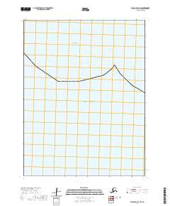
Pacific Ocean waters dominate this 2020 survey of the False Pass B-4 SE quadrangle in the Aleutians East Borough. The map is a rare example of a maritime-focused topographical sheet where no terrestrial landmarks or bathymetric contours are documented. According to the U.S. Geological Survey margin notes, elevation data for this specific area did not meet accuracy requirements, resulting in a minimalist representation of the open sea at the 1:25,000 scale. The map serves as a precise coordinate reference for this remote maritime corridor within the Aleutian chain.
Find a feature on this map
1 named feature on this map. Tap any name to fly to it.
Don’t see what you’re looking for? This feature index may not catch every label — zoom into the map to look around manually.
Map Details
Editions of this 2020 False Pass B-4 SE Map
This is the sole edition of this map. No revisions or reprints were ever made.