
1950 Map of False Pass
USGS Topo · Published 1950About this map
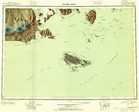
Unimak Island and the western tip of the Alaska Peninsula dominate this 1950 reconnaissance survey, centered on the vital maritime corridor of Isanotski Strait. The landscape is defined by the massive volcanic silhouettes of Shishaldin Volcano and Isanotski Peaks, looming over the small settlements at False Pass and Morzhovoi. These communities represent the primary human presence in a maritime environment where the economy was dictated by the tides of Bechevin Bay and the sheltering waters of Traders Cove. To the south, the Sanak Islands rise from the Pacific Ocean, showing the intricate coastline of Sanak Harbor and Pavlof Harbor. This map captures the region at a time when these remote outposts served as critical navigation points for the fishing fleets and transport vessels moving between the Bering Sea and the open Pacific.
Find a feature on this map
140 named features on this map. Tap any name to fly to it.
Don’t see what you’re looking for? This feature index may not catch every label — zoom into the map to look around manually.
Map Details
Editions of this 1950 False Pass Map
2 editions found
Other maps of this area

1943 · Fort Randall
USGS Topo · 1:250,000
1944 · Cold Bay Sheet No. 20 of 25
USGS Topo · 1:25,000

1949 · False Pass
USGS Topo · 1:250,000

1949 · Fort Randall
USGS Topo · 1:250,000

1950 · Fort Randall
USGS Topo · 1:250,000

1951 · Unimak
USGS Topo · 1:250,000

1953 · Port Moller
USGS Topo · 1:250,000

1958 · Unimak
USGS Topo · 1:250,000

1963 · Port Moller A-5
USGS Topo · 1:63,360

1963 · Port Moller A-6
USGS Topo · 1:63,360