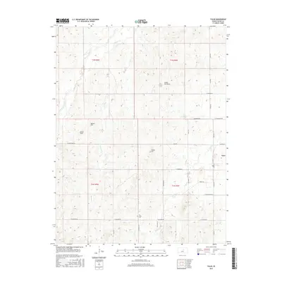
2015 Map of Falun
USGS Topo · Published 2015About this map
The settlement of Falun serves as the primary focal point in this section of central Kansas, where the landscape is defined by distinct geologic rises and a network of winding creeks. Significant elevations such as Soldier Cap Mound, Potato Hill, Weston Hill, and Coiner Dome punctuate the horizon, providing a dramatic contrast to the drainage basins of Ralston Cr and Spring Cr. The region is marked by a grid of rural roads, including W Salemsborg Rd and W Hedberg Rd, which connect far-flung agricultural properties. For those researching local history or genealogy, the Dry Creek Cem stands as an important site for identifying early residents. The mapping of W Dry Cr and Castle Cr illustrates the hydrological patterns that have shaped land use and settlement in this portion of Saline County.
Find a feature on this map
34 named features on this map. Tap any name to fly to it.
Don’t see what you’re looking for? This feature index may not catch every label — zoom into the map to look around manually.
Map Details
Editions of this 2015 Falun Map
This is the sole edition of this map. No revisions or reprints were ever made.
Other maps of this area

1892 · Salina
USGS Topo · 1:125,000

1942 · Salina
USGS Topo · 1:125,000

1955 · Salina SW
USGS Topo · 1:24,000

1955 · Smolan
USGS Topo · 1:24,000

1955 · Brookville
USGS Topo · 1:24,000

1955 · Falun
USGS Topo · 1:24,000

1955 · Hutchinson
USGS Topo · 1:250,000

1957 · Brookville SW
USGS Topo · 1:24,000
1957 · Venango
USGS Topo · 1:24,000

1959 · Hutchinson
USGS Topo · 1:250,000