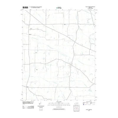
2010 Map of Fancy Farm
USGS Topo · Published 2010About this map
The agricultural landscape of Western Kentucky is defined by the winding course of West Fork Mayfield Creek and its many tributaries, such as Little Creek and Barnes Creek. Small rural communities anchor the region, including the crossroads of Kirbyton and the quiet settlement of Beulah near the southern border. This 2010 survey illustrates the deep-rooted local history through its many family and community burial grounds, such as Kirbyton Cemetery, Emmaus Cemetery, and Dodson Cemetery. The mapping of small roads like Dewey Corner Sch Rd and Alben Barkley Rd suggests the enduring importance of rural access to local homesteads. Further north, the namesake landmark of Lowe Lake sits near the confluence of Goose Creek and Wilson Creek, while the village of Wheel occupies a central position within the patchwork of fields and woodlots that characterize this part of Carlisle and Graves counties.
Find a feature on this map
46 named features on this map. Tap any name to fly to it.
Don’t see what you’re looking for? This feature index may not catch every label — zoom into the map to look around manually.
Map Details
Editions of this 2010 Fancy Farm Map
This is the sole edition of this map. No revisions or reprints were ever made.
Other maps of this area

1936 · Melber
USGS Topo · 1:24,000

1951 · Blandville
USGS Topo · 1:24,000

1951 · Milburn
USGS Topo · 1:24,000

1951 · Melber
USGS Topo · 1:24,000

1951 · Hickory
USGS Topo · 1:24,000

1951 · Hickory
USGS Topo · 1:62,500

1952 · Clinton
USGS Topo · 1:24,000

1952 · Mayfield
USGS Topo · 1:24,000

1952 · Dublin
USGS Topo · 1:24,000

1952 · Fancy Farm
USGS Topo · 1:24,000