
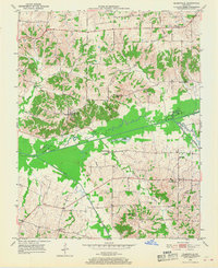
1951 Map of Blandville
USGS Topo · Published 1952About this map
Blandville sits at the heart of this early 1950s survey, marking a historical crossroads in the undulating terrain where the Ballard and Carlisle county line follows the course of Mayfield Creek. The landscape is defined by its intricate drainage systems, featuring landmarks like St Arbor Slough and the winding West Fork Mayfield Creek. The map documents a rural community structure centered around localized hubs such as Gage and Cunningham, where rural life was anchored by institutions like Shady Grove Ch, Bethlehem Ch, and Mayfield Creek Ch. For genealogists, the inclusion of family-named sites such as Martin Cem, Hall Cem, and Magee Springs offers a precise look at the mid-century social geography of western Kentucky before the expansion of modern highway systems.
Find a feature on this map
22 named features on this map. Tap any name to fly to it.
Don’t see what you’re looking for? This feature index may not catch every label — zoom into the map to look around manually.
Map Details
Editions of this 1951 Blandville Map
2 editions found
Other maps of this area

1928 · La Center
USGS Topo · 1:62,500

1931 · Cairo
USGS Topo · 1:62,500

1932 · La Center
USGS Topo · 1:62,500

1933 · Cairo
USGS Topo · 1:62,500

1939 · Wickliffe
USGS Topo · 1:62,500

1939 · Cairo
USGS Topo · 1:62,500

1949 · Paducah
USGS Topo · 1:250,000

1950 · Paducah
USGS Topo · 1:250,000

1951 · Arlington
USGS Topo · 1:24,000

1951 · Wickliffe
USGS Topo · 1:24,000