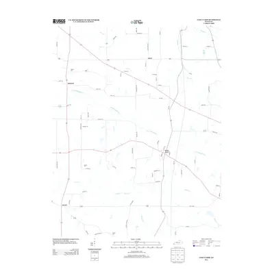
2013 Map of Fancy Farm
USGS Topo · Published 2013About this map
Fancy Farm serves as a primary hub for this western Kentucky landscape, where several rural communities are connected by a network of country roads and creek drainages. The area is defined by its agricultural character, with scattered settlements such as Kirbyton, Wheel, and Beulah linked by routes like Alben Barkley Rd. The terrain is shaped by the W Fork Mayfield Cr and its tributaries, including Little Cr and Lick Cr. Genealogists will find significant value in the documentation of local burial grounds, including Kirbyton Cem, Emmaus Cem, Dodson Cem, and Burgess Cem. To the northeast, the presence of Lowe Lake and the winding course of Goose Cr add variety to the predominantly agrarian layout of the quadrangle.
Find a feature on this map
73 named features on this map. Tap any name to fly to it.
Don’t see what you’re looking for? This feature index may not catch every label — zoom into the map to look around manually.
Map Details
Editions of this 2013 Fancy Farm Map
This is the sole edition of this map. No revisions or reprints were ever made.
Other maps of this area

1936 · Melber
USGS Topo · 1:24,000

1951 · Blandville
USGS Topo · 1:24,000

1951 · Milburn
USGS Topo · 1:24,000

1951 · Melber
USGS Topo · 1:24,000

1951 · Hickory
USGS Topo · 1:24,000

1951 · Hickory
USGS Topo · 1:62,500

1952 · Clinton
USGS Topo · 1:24,000

1952 · Mayfield
USGS Topo · 1:24,000

1952 · Dublin
USGS Topo · 1:24,000

1952 · Fancy Farm
USGS Topo · 1:24,000