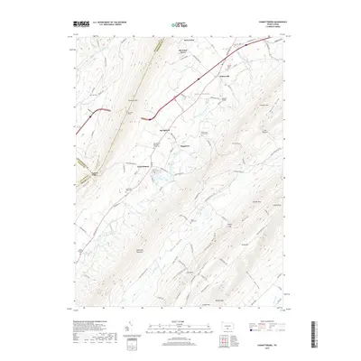
2019 Map of Fannettsburg
USGS Topo · Published 2019About this map
Fannettsburg and the rural townships of Path Valley are defined by a sequence of dramatic ridges and narrow agricultural corridors in this Franklin County survey. The landscape is characterized by the West Branch Conococheague Creek and Conodoguinet Cr, which cut through a series of parallel mountains including Tuscarora Mtn, Kittatinny Mountain, and Broad Mtn. Settlement is concentrated along the valley floors, with small clusters at Willow Hill, Boggstown, and Springtown.
Find a feature on this map
99 named features on this map. Tap any name to fly to it.
Don’t see what you’re looking for? This feature index may not catch every label — zoom into the map to look around manually.
Map Details
Editions of this 2019 Fannettsburg Map
This is the sole edition of this map. No revisions or reprints were ever made.
Other maps of this area

1900 · Mercersburg
USGS Topo · 1:62,500

1902 · Chambersburg
USGS Topo · 1:62,500

1902 · Mercersburg
USGS Topo · 1:62,500

1923 · Shippensburg
USGS Topo · 1:62,500

1939 · Orbisonia
USGS Topo · 1:62,500

1940 · Orbisonia
USGS Topo · 1:62,500

1942 · Hagerstown
USGS Topo · 1:125,000

1943 · Hagerstown
USGS Topo · 1:125,000

1943 · Chambersburg
USGS Topo · 1:62,500

1943 · Mercersburg
USGS Topo · 1:62,500
Featured Places
- Metal Township, PA
- Letterkenny Township, PA
- Hamilton Township, PA
- Mountain Green, Metal Township
- Boggstown, Metal Township