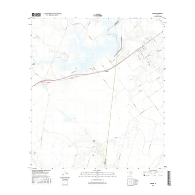
2016 Map of Fannin
USGS Topo · Published 2016About this map
Fannin and Cologne anchor this coastal plain landscape where the border of Goliad and Victoria counties meets. The terrain is defined by the winding course of the San Antonio River to the southwest and the expansive Coleto Cr Cooling Pond in the north. This modern survey reflects a region where traditional land features like Sand Hollow, Wade Reeves Hollow, and Portis Draw coexist with contemporary infrastructure. Local genealogy is supported by the presence of the Noble Cem near the historic rail corridor and the San Antonio Cem further south. The map details a dense network of local roads including Sulphur Creek Rd and San Antonio River Rd, which trace the drainage patterns of Sulphur Cr and Perdido Creek.
Find a feature on this map
55 named features on this map. Tap any name to fly to it.
Don’t see what you’re looking for? This feature index may not catch every label — zoom into the map to look around manually.
Map Details
Editions of this 2016 Fannin Map
This is the sole edition of this map. No revisions or reprints were ever made.
Other maps of this area

1953 · Beeville
USGS Topo · 1:250,000

1956 · Beeville
USGS Topo · 1:250,000

1960 · Beeville
USGS Topo · 1:250,000

1962 · Live Oak Lake
USGS Topo · 1:24,000

1962 · Fannin
USGS Topo · 1:24,000

1962 · Lott Lake
USGS Topo · 1:24,000

1962 · McFaddin
USGS Topo · 1:24,000

1962 · Hensley Lake
USGS Topo · 1:24,000

1962 · Raisin
USGS Topo · 1:24,000
1963 · Ander
USGS Topo · 1:24,000