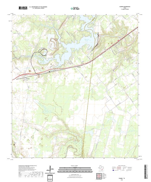
2022 Map of Fannin
USGS Topo · Published 2022About this map
Cologne and Fannin anchor this coastal plains landscape where the border between Goliad and Victoria counties follows the meandering course of Sulphur Creek. The geography is defined by its water management and agricultural drainage, most notably the large Coleto Creek Cooling Pond which dominates the northern sector. Genealogy researchers will find significant value in the distribution of local burial sites, including the Cologne Cemetery near the town center and the Noble Cemetery situated along N Old Hwy 59.
Find a feature on this map
63 named features on this map. Tap any name to fly to it.
Don’t see what you’re looking for? This feature index may not catch every label — zoom into the map to look around manually.
Map Details
Editions of this 2022 Fannin Map
This is the sole edition of this map. No revisions or reprints were ever made.
Other maps of this area

1953 · Beeville
USGS Topo · 1:250,000

1956 · Beeville
USGS Topo · 1:250,000

1960 · Beeville
USGS Topo · 1:250,000

1962 · Live Oak Lake
USGS Topo · 1:24,000

1962 · Fannin
USGS Topo · 1:24,000

1962 · Lott Lake
USGS Topo · 1:24,000

1962 · McFaddin
USGS Topo · 1:24,000

1962 · Hensley Lake
USGS Topo · 1:24,000

1962 · Raisin
USGS Topo · 1:24,000
1963 · Ander
USGS Topo · 1:24,000