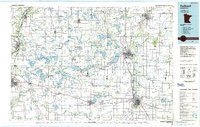
1985 Map of Faribault
USGS Topo · Published 1986About this map
The Minnesota River defines the western edge of this 1985 survey, carving through a landscape of glacial lakes and prairie creek systems. Regional education hubs are prominent, with St Olaf College and Carleton College anchored in Northfield, while Gustavus Adolphus College overlooks St Peter to the west. The mid-1980s transport network is defined by the Chicago and North Western rail lines and the path of US Highway 169 following the river valley.
Find a feature on this map
220 named features on this map. Tap any name to fly to it.
Don’t see what you’re looking for? This feature index may not catch every label — zoom into the map to look around manually.
Map Details
Editions of this 1985 Faribault Map
2 editions found
Other maps of this area

1950 · Mankato East
USGS Topo · 1:62,500

1951 · Mankato East
USGS Topo · 1:62,500

1951 · Mankato West
USGS Topo · 1:62,500

1953 · Saint Paul
USGS Topo · 1:250,000

1953 · New Ulm
USGS Topo · 1:250,000

1954 · Fairmont
USGS Topo · 1:250,000

1954 · Mason City
USGS Topo · 1:250,000

1957 · New Ulm
USGS Topo · 1:250,000

1957 · Mason City
USGS Topo · 1:250,000

1957 · Belle Plaine
USGS Topo · 1:62,500