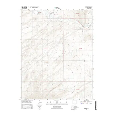
2016 Map of Farisita
USGS Topo · Published 2016About this map
Farisita and Badito serve as the primary settlement anchors in this section of Huerfano County, where the high-plains landscape is defined by the winding course of the Huerfano River. The map reveals an intricate network of water management essential to the region's ranching and agricultural history, documented through features like the García Ditch and Martin Ditch Number 2. These systems draw from mountain-fed tributaries including Turkey Cr and Oak Cr, illustrating the human adaptation to the arid environment. For those researching local families, the inclusion of Farisita Cem and Sanches Cem provides specific points of interest for genealogical study. The southern reaches of the quadrangle transition into more complex drainage patterns, where Dog Springs Arroyo and several named water sources like Horse Spring and Willow Spring break the terrain, while the course of Yellowstone Cr flows through the western sections toward the main river valley.
Find a feature on this map
37 named features on this map. Tap any name to fly to it.
Don’t see what you’re looking for? This feature index may not catch every label — zoom into the map to look around manually.
Map Details
Editions of this 2016 Farisita Map
This is the sole edition of this map. No revisions or reprints were ever made.
Other maps of this area

1889 · Huerfano Park
USGS Topo · 1:125,000

1891 · Walsenburg
USGS Topo · 1:125,000

1892 · Huerfano Park
USGS Topo · 1:125,000

1894 · Walsenburg
USGS Topo · 1:125,000

1897 · Walsenburg
USGS Topo · 1:125,000

1900 · Walsenburg
USGS Topo · 1:125,000

1954 · Trinidad
USGS Topo · 1:250,000

1955 · Trinidad
USGS Topo · 1:250,000

1958 · Trinidad
USGS Topo · 1:250,000

1959 · Trinidad
USGS Topo · 1:250,000