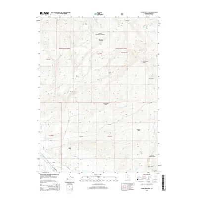
2014 Map of Farm Creek Peak
USGS Topo · Published 2014About this map
Ashley National Forest dominates the high-elevation landscape of this Duchesne County region, where the terrain shifts from the prominent Farm Creek Peak down into the productive bottomlands of the Uinta Valley. The map documents a sophisticated network of early 21st-century water management infrastructure designed to support the local agriculture, including the Farm Cr Canal, Little Farm Cr Canal, and the Jasper Pike Canal. These man-made features trace the natural contours of the land alongside the Duchesne River, illustrating the vital connection between water rights and settlement in this part of Utah. In the higher reaches, geographic points like Winchester Flat, Burnt Ridge, and Shotnick Basin offer precise locations for researchers tracking land use and resource extraction history within the forest boundaries.
Find a feature on this map
42 named features on this map. Tap any name to fly to it.
Don’t see what you’re looking for? This feature index may not catch every label — zoom into the map to look around manually.
Map Details
Editions of this 2014 Farm Creek Peak Map
This is the sole edition of this map. No revisions or reprints were ever made.
Other maps of this area

1885 · Uinta
USGS Topo · 1:250,000

1901 · Hayden Peak
USGS Topo · 1:125,000

1903 · Hayden Peak
USGS Topo · 1:125,000

1954 · Salt Lake City
USGS Topo · 1:250,000

1958 · Salt Lake City
USGS Topo · 1:250,000

1960 · Salt Lake City
USGS Topo · 1:250,000

1962 · Blacktail Mtn
USGS Topo · 1:24,000

1962 · Hanna
USGS Topo · 1:24,000

1962 · Tabiona
USGS Topo · 1:24,000
1962 · Tabby Mountain
USGS Topo · 1:24,000