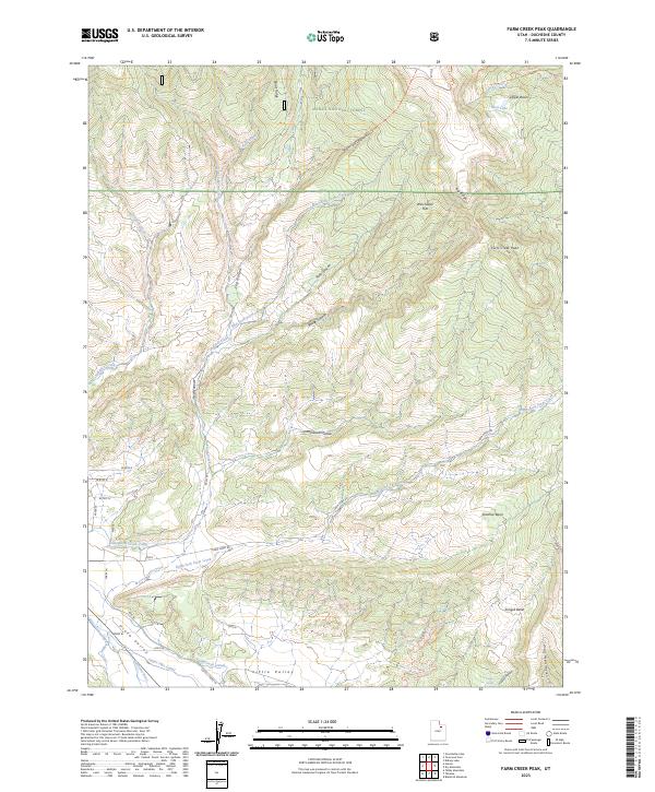
2023 Map of Farm Creek Peak
USGS Topo · Published 2023About this map
Ashley National Forest dominates this landscape, where the high elevation peaks of the Uinta range give way to a complex network of canyons and agricultural infrastructure. The transition from the high Farm Creek Peak and the alpine waters of Rock Lake down to the Uinta Valley reveals how water is managed in this arid environment. A series of waterworks, including the Little Farm Creek Canal, Farm Creek Canal, and Jasper Pike Canal, divert flows from the Farm Creek drainage toward the lower pastures and the Duchesne River. The map details many family-named landmarks such as Hicken Hollow and Jasper Pike Canal, which reflect the localized history of land use and water rights. Backcountry access is noted via the Corral Creek Trl and Rt Fork Log Hollow Trl, while the southern end of the sheet transitions into more established routes like CO RD 2 Tabby Ln.
Find a feature on this map
34 named features on this map. Tap any name to fly to it.
Don’t see what you’re looking for? This feature index may not catch every label — zoom into the map to look around manually.
Map Details
Editions of this 2023 Farm Creek Peak Map
This is the sole edition of this map. No revisions or reprints were ever made.
Other maps of this area

1885 · Uinta
USGS Topo · 1:250,000

1901 · Hayden Peak
USGS Topo · 1:125,000

1903 · Hayden Peak
USGS Topo · 1:125,000

1954 · Salt Lake City
USGS Topo · 1:250,000

1958 · Salt Lake City
USGS Topo · 1:250,000

1960 · Salt Lake City
USGS Topo · 1:250,000

1962 · Blacktail Mtn
USGS Topo · 1:24,000

1962 · Hanna
USGS Topo · 1:24,000

1962 · Tabiona
USGS Topo · 1:24,000
1962 · Tabby Mountain
USGS Topo · 1:24,000