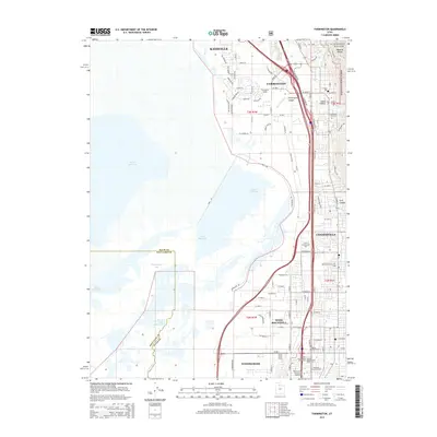
2014 Map of Farmington
USGS Topo · Published 2014About this map
The Wasatch Range forms a dramatic eastern wall for the growing corridor of Davis County, where the steep terrain of Steed Canyon and Ford Canyon gives way to a densely populated shelf of suburban and commercial development. This 2014 survey captures the rapid expansion of Farmington, Centerville, and West Bountiful as they press westward toward the fragile wetlands of Farmington Bay. The map reveals a complex water system where the Jordan River and the Old River Channel Jordan River meet the rising shoreline of the Great Salt Lake. Cultural and historical markers are preserved in the landscape, from the Farmington City Cem and David Wood Cem to specialized industrial zones like the Beehive Acres Commercial Subdivision and Woods Cross Siding, reflecting the area's role as a vital transportation and commercial hub.
Find a feature on this map
101 named features on this map. Tap any name to fly to it.
Don’t see what you’re looking for? This feature index may not catch every label — zoom into the map to look around manually.
Map Details
Editions of this 2014 Farmington Map
This is the sole edition of this map. No revisions or reprints were ever made.
Other maps of this area

1885 · Salt Lake
USGS Topo · 1:250,000

1885 · Tooele Valley
USGS Topo · 1:250,000

1925 · Ft. Douglas
USGS Topo · 1:125,000

1928 · Ft. Douglas
USGS Topo · 1:125,000

1950 · Fort Douglas
USGS Topo · 1:24,000

1951 · Fort Douglas
USGS Topo · 1:24,000

1951 · Saltair
USGS Topo · 1:24,000

1951 · Salt Lake City North
USGS Topo · 1:24,000

1952 · Saltair NE
USGS Topo · 1:24,000

1952 · Farmington
USGS Topo · 1:24,000