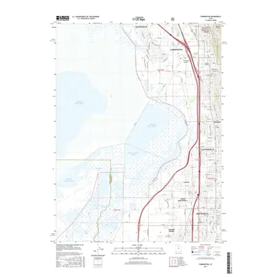
2017 Map of Farmington
USGS Topo · Published 2017About this map
The Wasatch National Forest towers over the residential corridors of the eastern Davis County bench, where the Wasatch Range meets the eastern shores of the Great Salt Lake. This 2017 survey details the dense suburban development of Bountiful, Farmington, and Centerville, illustrating how the modern built environment is constrained between the steep canyon mouths and the wetlands of Farmington Bay. To the east, steep drainage systems like Farmington Canyon and Ford Canyon provide a sharp contrast to the low-lying marshes where the Old River Channel Jordan River and the current Jordan River meander toward the lake. Genealogists will find the Farmington City Cem clearly marked near the foot of the mountains, while local historians can trace the transition between established municipalities and smaller neighborhoods like Valencia and Rosedale.
Find a feature on this map
83 named features on this map. Tap any name to fly to it.
Don’t see what you’re looking for? This feature index may not catch every label — zoom into the map to look around manually.
Map Details
Editions of this 2017 Farmington Map
This is the sole edition of this map. No revisions or reprints were ever made.
Other maps of this area

1885 · Salt Lake
USGS Topo · 1:250,000

1885 · Tooele Valley
USGS Topo · 1:250,000

1925 · Ft. Douglas
USGS Topo · 1:125,000

1928 · Ft. Douglas
USGS Topo · 1:125,000

1950 · Fort Douglas
USGS Topo · 1:24,000

1951 · Fort Douglas
USGS Topo · 1:24,000

1951 · Saltair
USGS Topo · 1:24,000

1951 · Salt Lake City North
USGS Topo · 1:24,000

1952 · Saltair NE
USGS Topo · 1:24,000

1952 · Farmington
USGS Topo · 1:24,000